What the Barton Creek Greenbelt actually is
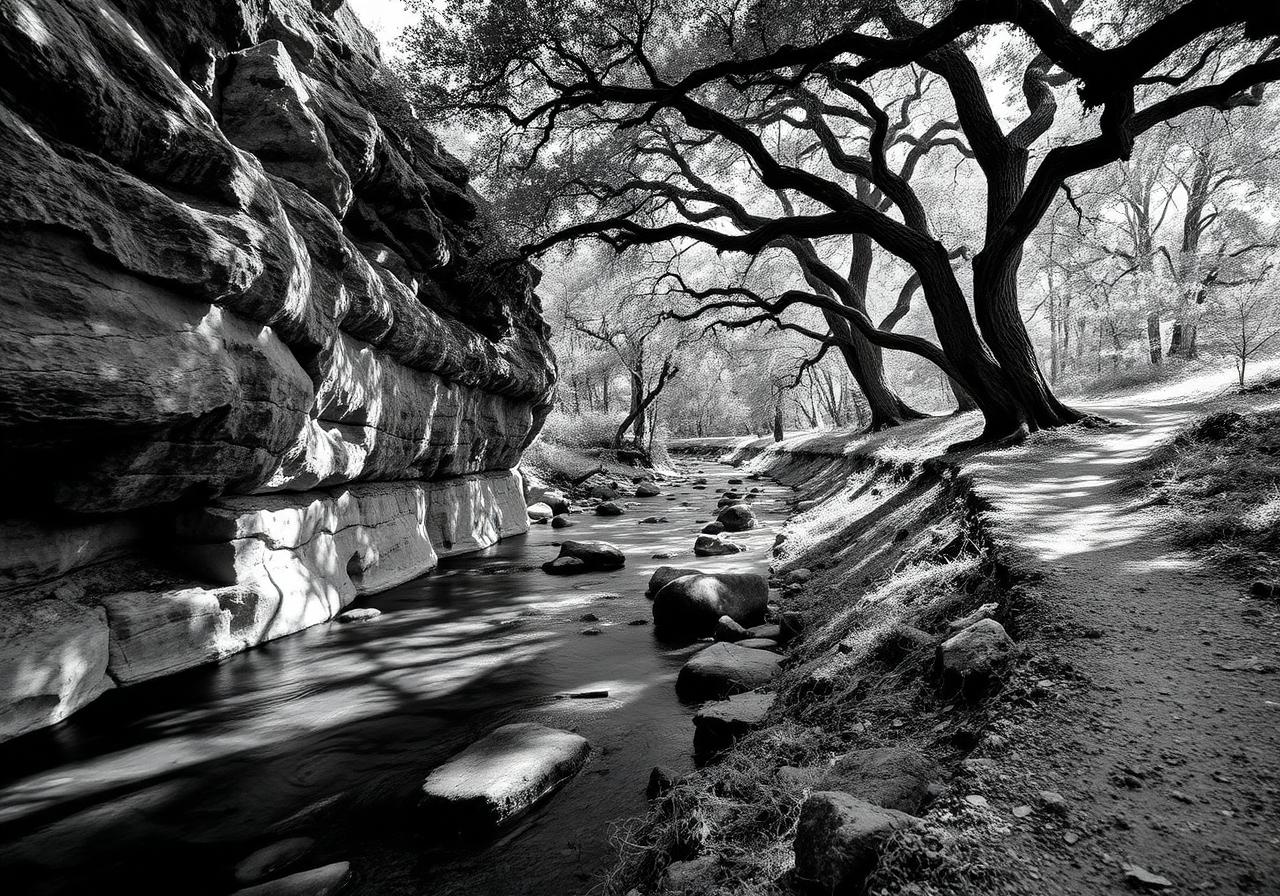
The Barton Creek Greenbelt is a 7.25-mile protected corridor of public parkland managed by the City of Austin Parks and Recreation Department. It runs from near Zilker Park in the east to the Lost Creek neighborhood in the west, following Barton Creek through densely forested limestone canyons. The trail is open daily from 5 a.m. to 10 p.m.
The greenbelt is part of a larger conservation effort that has protected over 35,000 acres in the Barton Springs Edwards Aquifer recharge zone. This isn't just a hiking trail. It's critical infrastructure for Austin's drinking water and habitat protection.
How Travis Country residents access it
You don't have to drive anywhere. Travis Country's design includes direct trail connections to the Barton Creek Greenbelt. The Travis Country Access Trail, a white gravel path roughly 1,100 feet long, connects from the neighborhood greenspace near Canyonwood Drive and Travis County Circle, and from Eagles Landing at Copperwood Drive. From those access points, you enter the lower section of the greenbelt proper.
The neighborhood also features 1.5 miles of dedicated nature trails linking the Hilltop and Blue Valley amenity centers, which themselves connect to the greenbelt system. You realistically have multiple small trails within walking distance of any Travis Country home.
Named features worth knowing
Twin Falls and Sculpture Falls are popular destinations along the greenbelt, reachable from the main access point near Loop 360. Twin Falls is a shorter hike in, with Sculpture Falls about 1.25 miles farther. Both are swimming destinations when water levels allow.
Gus Fruh is an access point that leads to a section of Barton Creek known for a rope swing and what locals call the "Gus Fruh Pool," a wide, deep section that sometimes holds water year-round. The limestone walls here attract rock climbers, particularly at the Urban Assault climbing area.
The Hill of Life is a distinctive half-mile stretch of steep switchbacks at the Camp Craft Road end of the trail, earning its name from the physical demand of the climb.
Campbell's Hole is a swimming destination accessible roughly 0.5 miles from the Spyglass access point, making Spyglass one of the quickest ways to reach this spot when water conditions cooperate.
Seasonality and water flow
Barton Creek is an intermittent stream. It doesn't flow year-round at normal water levels. After rain, sometimes during spring months, or after particularly wet periods, the creek flows. During dry stretches, it's mostly pools and dry rock.
The Hill of Life Dam and Sculpture Falls area are the upstream holes most likely to hold water during dry spells. What you're getting beyond the water is the experience of hiking through a genuine canyon ecosystem in limestone country, whether water is flowing or not.
How people actually use it
- Hiking and running dominate. Trail traffic is heaviest early morning and evening, lighter in midday heat.
- Mountain biking is permitted on the main greenbelt trail. Cyclists ride single file, signal when passing, and yield to pedestrians. The terrain is rocky and uneven, so road bikes don't work here.
- Swimming happens in the named pools when water conditions allow, only in those specific designated areas.
- Rock climbing happens at Urban Assault and other limestone walls.
- Dogs on a 6-foot leash, every time. The $500 fine for off-leash violations is enforced.
Flooding and when to avoid the trail
Flash flooding is the real hazard. Barton Creek drains an area with sloped topography in the Hill Country and clay soils in lower elevations, which creates fast runoff. If you hear heavy rain upstream, the creek can rise quickly without warning. Avoid the greenbelt during and for several hours after heavy rain.
Why it matters for your home
A shared trail system you can walk to from your front door is not typical real estate value. Most of Austin requires you to drive to natural areas. Travis Country residents don't. The greenbelt is why homes here command the values they do, and it is the single biggest lifestyle multiplier of living in 78735.